Business content
Business concept of our corporation
Safe and secure land development
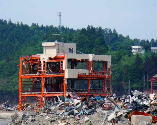
As about 70% of lands in the Japanese archipelago are mountainous, there are limited areas that are safe and secure from volcanic disasters, sediment disasters (landslides, steep slope disasters, soil and sand flows) in mountainous areas with steep slopes, floods, liquefaction, and tsunamis. The Japanese islands are the so-called kingdom of disasters. Mr. Torahiko Terada, a famous physicist, essayist, and haiku poet, said “A disaster strikes when people do not expect it.” However, it is true that disasters have come one after another in recent years.
Disasters within recent memory include the Hanshin-Awaji earthquake (1995), the East Japan earthquake (2011), Mount Ontake eruption (2014), Kinugawa River flooding (2015), and Kumamoto earthquake (2016). We acquired a great deal of knowledge from these disasters; therefore, the potential dangers of natural disasters and dangerous areas should be surveyed. We would like to contribute to strong land formation for the reduction of disasters.
Surveys of natural elements (geography, geology, vegetation, soil, etc.) and urban elements (land use, structures, and disaster history) to obtain basic information for disaster prevention were carried out, so that we can contribute to the creation of a durable land.
Disaster prevention assessment and hazard map creation
For the sake of preventing and mitigating various disasters (sand flow disasters, ground disasters, and wind/water flow disasters), we survey and organize disaster inducements, disaster factors, and disaster history, and we are able to offer our report in the format requested by the customer. Moreover, a regional disaster prevention plan and disaster prevention prescription by districts will be produced. Collection and analysis of various kinds of information, such as regional damage prediction, will be arranged. In the hazard protection map, we offer the necessary format after collection, analysis, and arrangement of disaster damage predictions after checking the appropriate items and places.
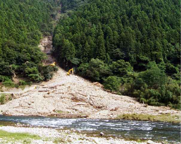
Sediment disaster prevention survey
Sediment disasters include land flow, ground flow, and slope failure. These disaster types and degrees of risk are different in various places. We perform a basic survey based on the Landslide Prevention Law, as well as a desk survey of road disaster prevention inspection. A report based on the field survey and GIS data maintenance will be produced.
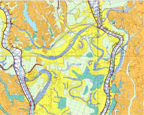
Land condition survey
We collect data of the land condition (geography, geology, and soil), survey basic disaster prevention and land use planning information, input GIS data, and produce a map and a report. In the cases of a flood control geographic classification map for flood prevention and disaster reduction and a land condition map for the classification of geographical conditions for disaster countermeasures, we extract information regarding ground flow and terrain collapse from terrain interpretation, ground flow, and collapsed terrain using aerial photos. A basic survey based on various thematic maps and decipherments will be produced. Geographic analyses and a thematic map based on useful DEM data for terrain, interpretation, and geographic analyses are provided.
Source:Geospatial Information Authority of Japan