Business content
- Geographic survey
- Natural environment survey
and
soil pollution countermeasures - Urban planning
- Geographic
information system
Business concept of our corporation
Geographic information system
The geographic information system is the basis of the urban disaster prevention basic survey, disaster assessment, environmental assessment, and urban planning basic survey. We can offer a database after compiling the analog, digital, and GIS information of the necessary and basic data. We organically use various information systems to plan, design (dealing with various established software), customize, and create.
The geographic information system is the basis for the city disaster prevention basic survey and assessment, environmental assessment, and city planning basic survey. Our company can offer the data by compiling data tasks in analog, digital, and GIS formats. We design for various information systems (handled using various software) and customize and create the reports organically.
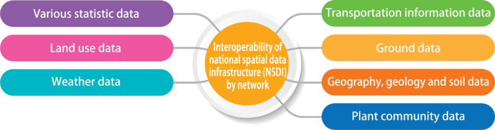
Data creation of a GIS system
Our company collects and organizes the geographic information data for the urban development plan, disaster prevention assessment, environmental assessment, and land survey, and offers the results in analog, digital, and GIS formats.

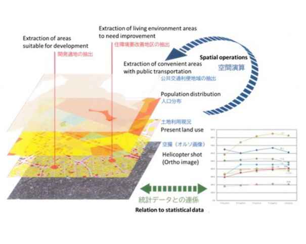
Remote sensing
Remote sensing technology by artificial satellite and airplane provides data on the ground, ocean, and atmosphere. From surveying from a high position, we can obtain a wide area of information on global environment mechanisms all at once, as well as the effect of human activities. The future of the global environment will be predicted by the simulation using the data acquired.
Design of various information systems
We have the software of various general information systems. Therefore, we can establish the necessary information systems promptly according to the customer’s request.
Source:Geospatial Information Authority of Japan